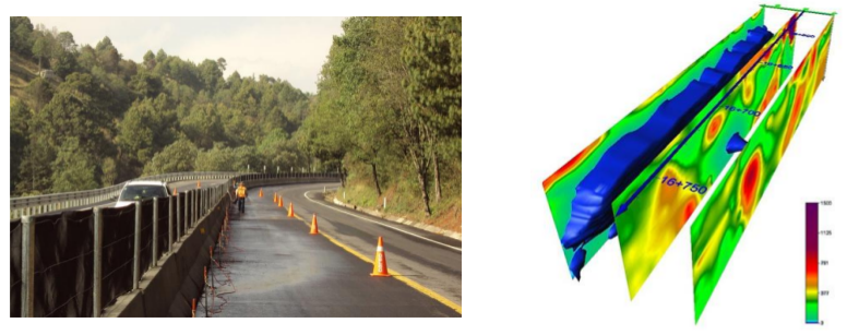
Electrical Resistivity Tomography (ERT)
This method attends the same principle as the vertical electrical sounding, with the difference that the ERT allows us to obtain results in 2D or 3D by acquiring multiple resistivity measurements, resulting in a lateral and vertical subsoil characterization.
The ERT is a versatile tool that is helpful to understand a wide range of problems occurring in the near subsurface, and it’s commonly used for:
- General characterizations
- Cavities and voids location
- Archeological sites
- Delimitation of water filtration, saline intrusions and polluted subsoil areas

Pseudo-3D geoelectric survey for the monitoring of a road section that presented problems due to water filtrations, which are shown in blue in the results image above.


